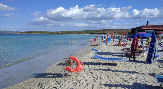
 ©
Angelo Piras
©
Angelo Piras
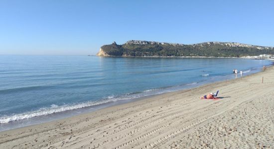
 ©
Vincenzo Cuccu
Google
©
Vincenzo Cuccu
Google
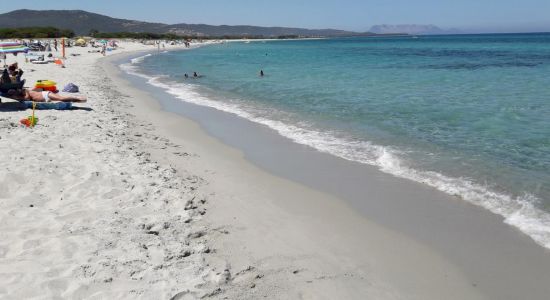
 ©
Angelo Piras
Google
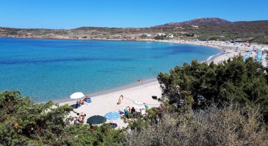
©
Angelo Piras
Google
 ©
Luca Pia
Google
©
Luca Pia
Google
 ©
Pier Sergio Saba
Google
©
Angelo Piras
©
Pier Sergio Saba
Google
©
Angelo Piras
 ©
Vincenzo Cuccu
Google
©
Vincenzo Cuccu
Google
 ©
Angelo Piras
Google
©
Angelo Piras
Google
 ©
Luca Pia
Google
©
Luca Pia
Google
 ©
Pier Sergio Saba
Google
©
Pier Sergio Saba
Google
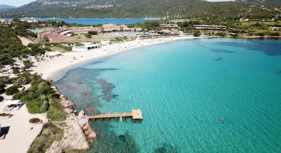
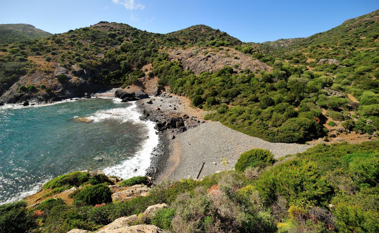
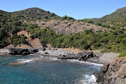
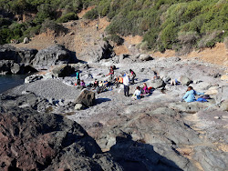
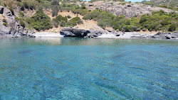
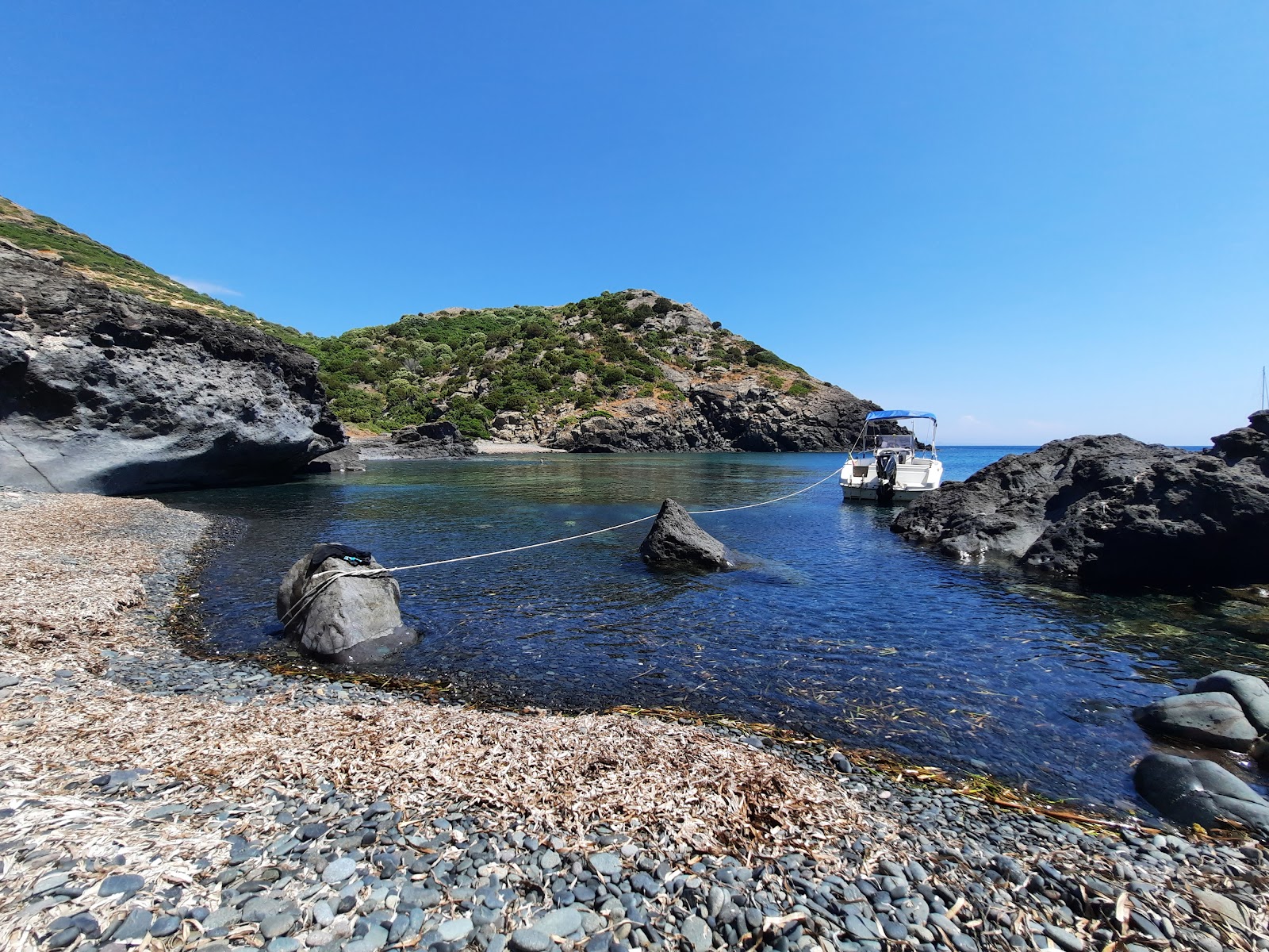
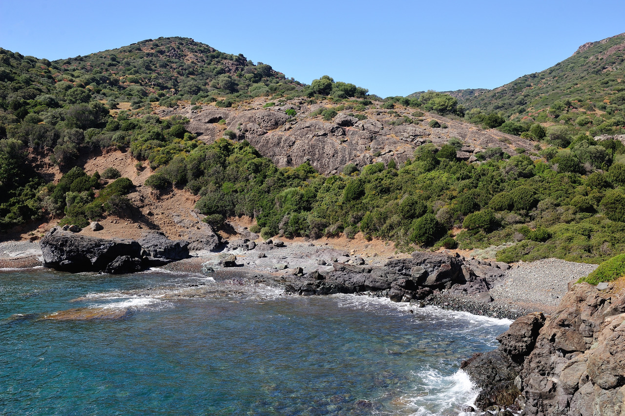
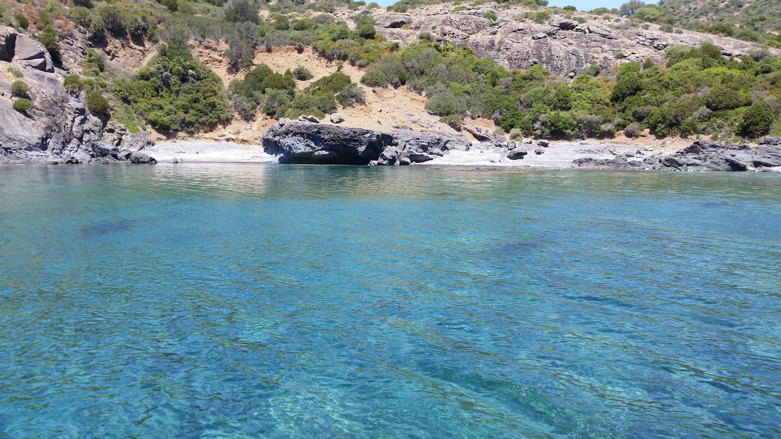
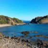
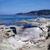
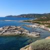
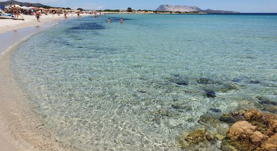
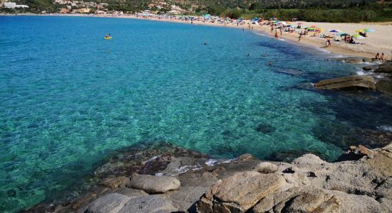
Cala Bernardu
Nasıl gidilir
Plaj hakkında
Erişim ve Düzen – Yürüme mesafesi, İşletme bilgisi
Güvende kalın, zamandan tasarruf edin ve gitmeden önce bilgi sahibi olun
Hava durumu
Bosa Marina, Sardinya Bölgesi, Oristano İli
Mevcut bölgedeki tüm plajlar
Hedef kitle
Doğal özellikler
-
Park/korunan alanda
-
Dağlar
-
Kayalık yamaçlar
-
Gri çakıl
-
Deniz dibi: çakıllar
-
Derinlik artışı: orta
-
Berrak mavi su
-
Dalgadan korunaklı — yer yer
-
Deniz ayakkabısı önerilir
-
Sahilde tekne: az
Olanaklar
Etkinlikler

Alghero : Morning Sailing Slow & Bath Stops (Adults Only)
If you love to start the day at your own pace and take refuge away from the hustle and bustle, this morning sail is designed for you. It's a slow experience, to unplug aboard a 2-masted sailboat (10-meter ketch sailing ship). We will leave in the morning from the port of Alghero and glide silently along the historic walls of the center. You will have the perfect space to relax, chat or enjoy the view in silence. During the tour we will make two bathing stops: the first with the Alghero skyline in the background, the second in the calm and transparent waters near the Maddalenetta area, ideal for swimming in total tranquility. The group is limited to a maximum of 6 adults: no crowded groups, no noisy boats. On board you will be greeted by a skipper who speaks Italian, German and a little English, ready to make you feel at home and answer your curiosity about the coast. In about 2.5 hours you will experience the best of Alghero's sea before lunch.

Bosa Coastal Discovery – Private Shore Tour from Alghero Port
This private tour from Alghero to Bosa offers a wonderful experience of Sardinia's scenic beauty and rich history. Starting from Alghero Cruise Port, you will enjoy a comfortable drive through the Sardinian countryside, with a stop at Capo Caccia for breathtaking views of the cliffs and coastline. Next, you’ll visit the ancient Palmavera Nuraghe, a fascinating prehistoric site that provides insight into the island’s ancient civilization. The journey continues to the charming village of Bosa, where you can wander through its colorful streets. After exploring Bosa, the tour will take you back to the Alghero Cruise Port. With a duration of approximately 5-6 hours, this tour is a perfect blend of nature, history, and culture, offering you a deeper connection with the island’s heritage.

Sailboat Exclusive Use with Sunset Aperitif Adults Only
Discover the beauty of the Coral Riviera with an exclusive sunset aperitif on a sailing boat, designed for adults. This 2.5-hour experience offers an intimate and sophisticated atmosphere, with up to 6 guests on board (the boat could accommodate up to 12). Sail sailing, with a sailing ship with 2 masts (ketch) in silence in contact with the sea. Enjoy a refreshing swim at sunset and savor an aperitif prepared with local Sardinian ingredients. Sip selected drinks, including cocktails and wine, while watching the sunset over Capo Caccia. An unforgettable experience for those seeking relaxation and beauty.

Sailing tour with PAG (AUDIOGUIDE) and typical Sardinian cuisine
If you choose us for your sailing tour, you will find yourself immersed in an unforgettable adventure along the Coral Riviera of Alghero, an experience destined to leave an imprint in the heart of whoever will live it. The day begins with a warm welcome from the skipper who will make you feel immediately at ease. The friendly and joyful atmosphere of the group will involve you from the first moment. You will be carried away by the waves and the soothing sound of the sea exploring hidden coves. With proximity audio guides (PAGs), the territory is told as you navigate and admire unique views in 6 languages. The cliffs will captivate you, giving you moments of contemplation and serenity. You can swim in crystal clear waters surrounded by marine life; these places will make you feel in harmony with nature. Moments of sharing and laughter with fellow travellers can create authentic and precious bonds. Lunch on board will then be a feast of local flavors.

Alghero - Sailboat trip with lunch on board,
Our Tour is dedicated to all people and children, we will have the pleasure of sailing on a sailing boat in full respect of the marine environment, we will be able to meet dolphins and you will be able to try and steer a sailing vessel accompanied by our skipper. On board we have masks and snorkels available for snorkeling, and a SUP board.

Departure Private Transfer Alghero City to Alghero Airport AHO by Minivan
Why spend your precious time waiting in long shuttle or taxi lines. Avoid the language barrier and currency exchange. Travel in style from your Hotel in Alghero City to Alghero, Riviera del Corallo Airport AHO by private vehicle and reach your final destination relaxed and refreshed.

Sunset aperitif on a sailing boat in Alghero
Do not miss the opportunity to live a unique experience aboard a Sailing Boat, enjoying a delicious aperitif at sunset! We will open the sails and sail in front of the cities of Alghero, after crossing the Island of Maddalenetta, a lovely place to drop anchor for a regenerating dip in the crystal clear waters of Sardinia. On board you can relax, swim or simply admire the panorama, the fascinating panorama. During the stopover, the skipper will prepare tasty snacks, and offer cool drinks, and good local wine, accompanied by good music creating a unique and special atmosphere. Whether you are looking for a romantic moment, an evening with friends or an authentic experience, our tour is the ideal choice to give you a magical evening that you will always take with you. Book now and get on board!!!

Sailing Experience to Capo Caccia from Alghero
Our tour along the north-west coast of Sardinia offers a unique and unforgettable experience, exploring hidden gems such as Capo Galera, Cala Dragunara and Punta Negra. With the authorization for the Porto Conte Marine Protected Area, we guarantee an experience that respects the environment and biodiversity. Enjoy the authenticity of Sardinian cuisine with appetizers and lunch on board, prepared with local ingredients. Taste typical products, all accompanied by local wine. Comfort and relaxation on board, with the freedom to explore at your own pace. Take advantage of the SUP and snorkeling equipment provided, to immerse yourself in the crystal-clear waters and discover seabeds rich in life. Admire spectacular views such as the cliffs of Punta Giglio and the turquoise waters of the Bombarde. Every detail is designed to make you experience an unparalleled adventure. For safety, given the nature and complexity of maneuvering of the 1978 vintage MotorSailer, navigation will be by motor.

Alghero: Jeep tour to discover nature and breathtaking landscapes
Our adventure begins in Alghero, ascending into a more secluded and uninhabited inland area. Along the way, we'll share the contrasts between Alghero and the rest of the island as you take in the breathtaking views of the Gulf of Alghero. We will pause to discuss the native plants of the Mediterranean scrub and their traditional uses. Leaving the main road, we'll venture onto a secondary path traditionally used by local shepherds to navigate between their lands. This journey will lead us to a unique panoramic viewpoint offering a stunning vista of the entire Gulf of Alghero—a sight not to be missed! As we continue, we’ll pass through cork oak forests where you'll learn about cork production. Our next stop is an archaeological park, where you'll dive into the history and culture of the Nuragic civilization. The journey takes us back along the coast, providing an opportunity to spot and admire griffon vultures, the majestic lords of the wind. Before heading back, we'll make a final stop at a nearby beach to enjoy a typical Sardinian aperitif featuring local delicacies.

Sunset and Aperitif on a Sailing Boat in Alghero
Experience an exclusive tour in Alghero that offers an unforgettable experience. We start from the port and sail along the historic medieval walls, admiring them from the sea. We continue towards the enchanting island of Maddalenetta, where you can swim and dive into the crystal clear waters. While you relax, our skipper prepares a delicious aperitif with local wine and appetizers, to the rhythm of music. Enjoy the sunset and a magical atmosphere, in total comfort and relaxation. Book now for a unique adventure! Due to the nature of our 1978 MotorSailer and the complexity of sailing, which requires specific wind conditions, the trip will be made by motor. We have chosen to focus the onboard experience on guests' enjoyment and appreciation of nature, rather than pure sailing. The two hours would not be enough for a real sailing experience, which would require strong winds, not always pleasant for those who are not used to it.

Alghero Walking Tour with Audio and Written Guide by a Local
If you're looking for a fun and curious way to visit Alghero, you've come to the right place! With this digital guide created with the support of a local, you will be able to visit all the most important monuments at your own pace. You'll get to know the stories and curiosities of Alghero! But also you will discover everything about local foods, Italian Aperitivo in authentic local restaurants, and much more!

Sailing day trip on Tall Ship Andrea Jensen with Lunch and Wine
Andrea Jensen is a unique sailing experience with British crew. An 86 year old, Danish sailing ship, with a traditional gaff rig, one of a kind in Sardinia. During the day cruise, you will join a very small group of guests who will share this once in a life time experience. The tour offers quality and service, the best boat trip in Alghero by far. Sail from port and explore the stunning coast to Capo Caccia, along the infamous Coral Riviera and stop in Porto Conte Bay. Take in the beautiful scenery, whilst relaxing on board, chatting to new friends or just chill on deck. Freshly prepared lunch on board. During a 2 hr stop, there is an opportunity for swimming and snorkeling in a beautiful, secluded bay, with breath taking, crystal clear water. Enjoy our selection of local wines or beer (soft drinks and water are also available). All inclusive. In the afternoon, you can help to raise the sails for a gentle sail back to Port. Fun, sun and sailing. Dolphins may join us if you are lucky!

Guided Wine and Olive oil tasting
Small artisanal winery located inside Porto Conte Natural Reserve. Female business, great care of visitors.

Alghero - Small Beaches Tour by E-bike more aperitif
A bicycle tour suitable for everyone, which will give you the opportunity to get to know Sardinia and its wonderful beaches thanks to the routes that our experience has created especially for our visitors. A unique and at the same time simple and fun tour to better enjoy a holiday in Sardinia. We will visit the most secret and silent beaches where you can sit and admire the beauty of the Alghero sea. We will cross paths rich in vegetation and aromas of the Mediterranean scrubland to arrive at the tip of the giglio peak from where we could observe Capo Caccia and the bay of Porto Conte from a unique position. At the end of the tour an aperitif will be offered with typical local products.

Sunset tour on a sailing boat with aperitif or dinner
If you choose us for the sunset tour you will live an exclusive 2-hour experience that will set you apart from any other vacationer in Alghero. We are the only ones to offer PAG, innovative proximity audio guides in 6 different languages that turn navigation into a personalized storytelling around you. Once out of the port, we will sail under the ancient Aragonese walls where we will turn off the engine to let the current carry us in magical silence, accompanied by good selected music while our audio guides will reveal the secrets and history of this city. At the island of Maddalenetta we will taste a glass of local wine accompanied by appetizer but if you want you can also book dinner with local products. But the most exclusive moment will be the return at night: admire the illuminated port of Alghero that shines like a Christmas nativity scene is an experience that only we can offer you, making your evening unforgettable and inimitable
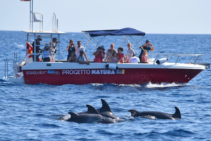
Alghero - Dolphin Watching and Guided Snorkeling (summer tour)
Live a day as a researcher with the scientists of MareTerra NGO. All your curiosities about dolphins will be satisfied. Observe the researchers as they collect scientific data to study the bottlenose dolphin population of the Gulf of Alghero. Discover the stories of some of the most famous dolphins like Suzeo, Taz or Shark Junior. During snorkelling, you'll have a guide who will take you to discover underwater life. On board, we'll tell you some curiosities about what we have seen. You will never be alone! Our excursions are inspired by the principles of ecotourism and sustainability: - Latest generation boat engines reduce fuel consumption and reduce the emission of noise underwater. - HQWW certification (High Quality Whale Watching) for whale watching operators complying with the Code of Good Conduct. This serves to reduce and minimize the disturbance of cetaceans. - Environmental education on board. - By joining Progetto Natura, you can support MareTerra NGO and its scientific research and conservation projects.

A day excursion to La Maddalena
Discover the wonders of the La Maddalena archipelago on a day tour! The 4 long stops planned will allow you to explore uncontaminated landscapes in complete tranquility. You will be able to relax on the beach pampered by white sands, dive into crystal clear waters unique in the world and enjoy breathtaking views. The Riviera Di Gallura is a modern vessel equipped with every comfort, the top of safety and comfort, with appropriately sized interiors and quality equipment. Ideal for a comfortable tour of the La Maddalena Archipelago. Don't miss out on this protected paradise and trust us! We were the first to offer this service, and for more than 40 years we have had the honor of accompanying visitors to the islands of the La Maddalena Archipelago.

Olbia Catamaran Tour for Dolphin Research and Tavolara Marine Park
Board a brand new catamaran from 2026 and discover some of the most spectacular wonders of northeastern Sardinia. The departure is from Marina di Olbia (MOYS), just a few minutes from the international airport. During the navigation we will skirt Figarolo and Cala Moresca, an area where it is frequent to spot dolphins. The tour then continues towards the beautiful Tavolara Island, symbol of the Tavolara-Punta Coda Cavallo Marine Protected Area. During the day there are stops to swim and relax in crystal clear waters, which may include spectacular places such as the Molara Swimming Pools, Porto Istana, Cala Girgolu or Capo Ceraso, depending on the weather and sea conditions, always assessed by the skipper. An unforgettable day between turquoise sea, wilderness and relaxation aboard an elegant catamaran.


Yakındaki tesisler
Konum
Bu plaj
Yerleşimler
Bosa Marina • 9,2 km
Aristanis Oristano • 51 km
Ulaşım
AHO • 33,7 km
Bosa Marina • 9,2 km
Stazione Sindia • 22,6 km
Yerleşimler
Bosa Marina • 9,2 km
Aristanis Oristano • 51 km
Ulaşım
AHO • 33,7 km
Bosa Marina • 9,2 km
Stazione Sindia • 22,6 km
Gezginlerin İncelemeleri
Gezginlerin İncelemeleri
Diğer gezginlerle deneyimlerinizi paylaşın


Sardinya Bölgesi, diğer popüler plajları kontrol edin
Tuerredda Plajı
La Pelosa Plajı
Marinella Plajı
Pittulongu Plajı
Poetto Plajı
Budoni Plajı
La Marinedda Plajı
Isuledda Plajı
Solanas Plajı
Pazzona Plajı
Berchida Plajı